Bring the days together
Add any number of Trimble JobXML (.jxl) and 12d field files (.fld), across files and days. Repeated shots are counted once.

Windows app · Version 0.1.0
Least-squares adjustment for total-station control networks. Bring together your field files, review the results and write adjusted coordinates back to a copy of your control CSV.
Coming soon. Register your interest in ControlAdjust.
Register interestAlready have a licence? Your licences and downloads
64-bit Windows 10 (1809 or later) or 11 · Offline · About 80 MB installed
An advisory QA aid. The surveyor decides; professional decisions and sign-off remain with the registered surveyor.
What it does
Add any number of Trimble JobXML (.jxl) and 12d field files (.fld), across files and days. Repeated shots are counted once.
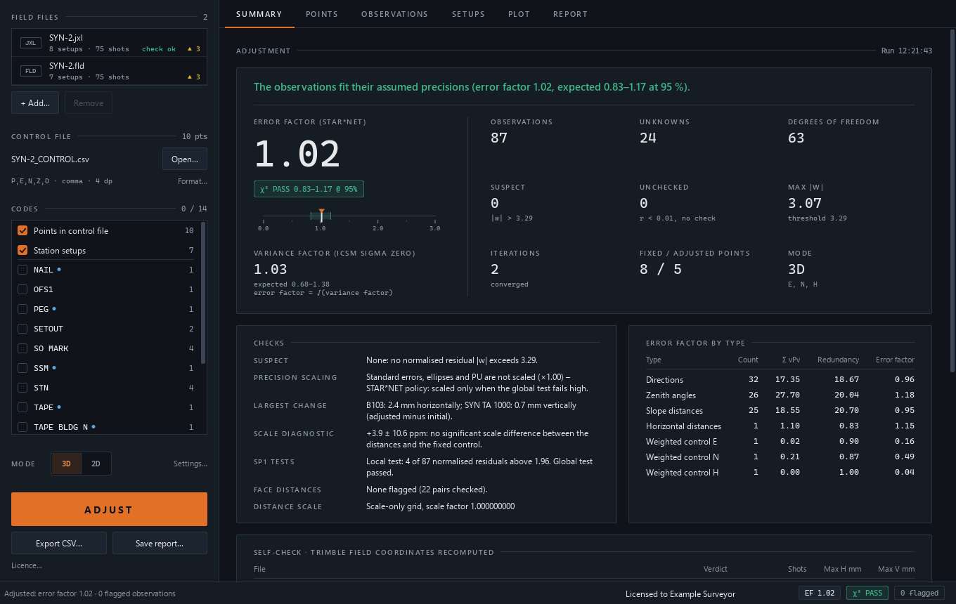
Least-squares adjustment of resections, traverses, rounds and both faces, STAR*NET-style in 3D or 2D. Weights come from the instrument record.
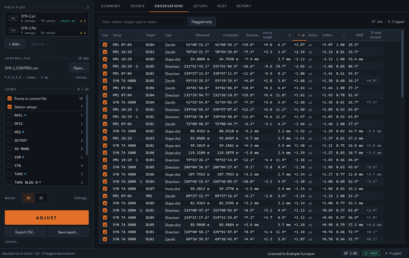
A chi-square global test shows the error factor. The Baarda w-test highlights suspects above 3.29, with plain advice such as “set this held mark Free first”.
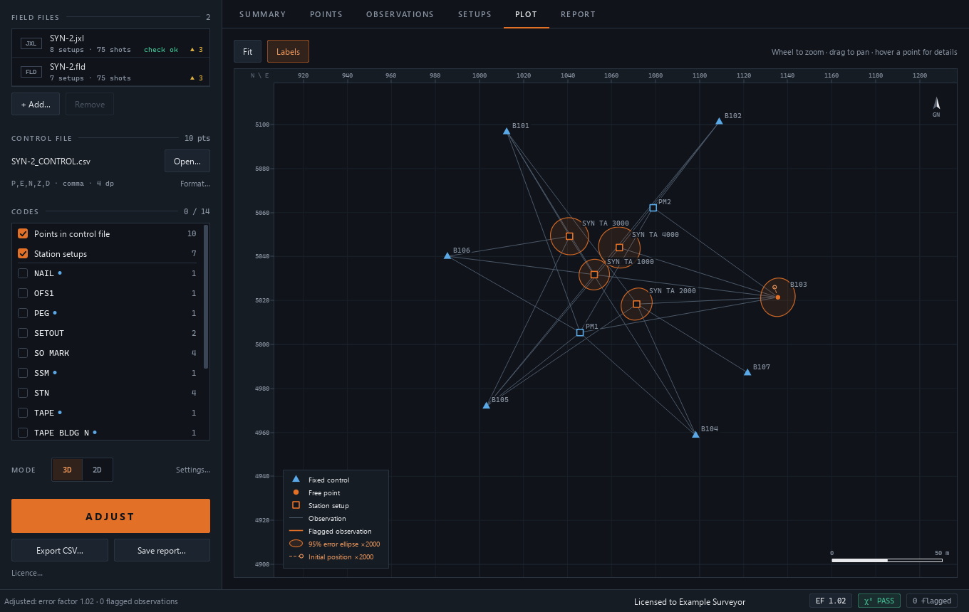
Review 95% error ellipses and ICSM SP1 PU/RU, alongside a scale diagnostic and a face-1/face-2 distance check.
A self-check recomputes Trimble Access’s own field coordinates from raw JobXML observations. In Tim’s testing it reproduced 5,748 field shots to 0.0001 mm. This describes that test set, not survey accuracy.
Export adjusted coordinates into a copy of your control CSV in exactly its format. Only adjusted values change and new marks are appended. Input files are never overwritten. Save a text report alongside it.
Six steps
Add your JobXML and 12d field files, including multiple days.
Start with the control file you already use.
Choose the codes to include as new marks.
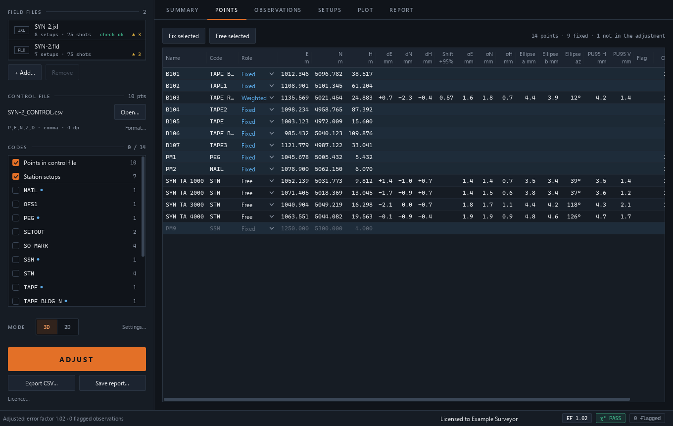
Set each mark to Fixed, Fix EN, Fix H, Free or Weighted.
Press ADJUST, then work through the diagnostics and advice.
Write a new control CSV and save the text report.
Inside the app
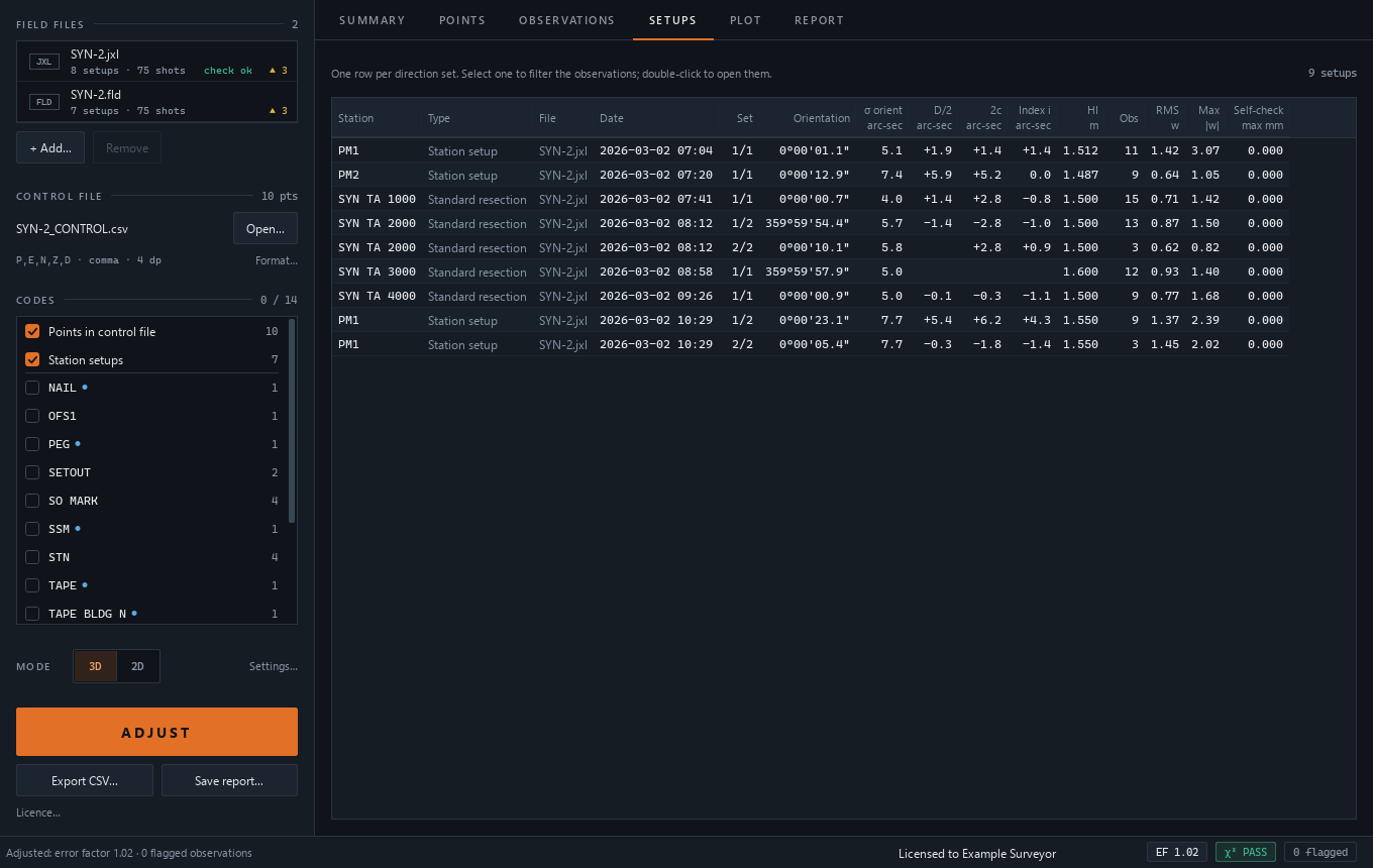
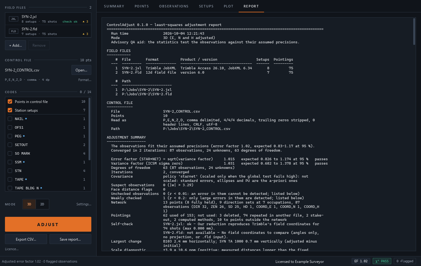
Open any screenshot to see the synthetic example at full size.
Requirements
Read before use
MGA2020 projection jobs are implemented, but have not yet been checked against a real MGA JobXML export.
No GNSS vectors or level runs. Review the inputs, mark roles, weights and output before using the results in your work.
ControlAdjust is an advisory QA aid. It does not replace registered surveyor judgement.
Questions
ControlAdjust uses an offline licence key. Get in touch about the tool.
Coming soon. Register your interest in ControlAdjust.
Register interestAlready have a licence? Your licences and downloads